
Trashiyangtse District topographic map
Interactive map
Click on the map to display elevation.
About this map
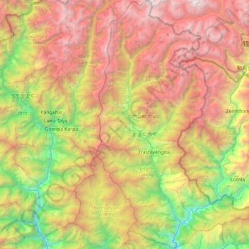
Name: Trashiyangtse District topographic map, elevation, terrain.
Location: Trashiyangtse District, Bhutan (27.36926 91.29720 28.00877 91.76830)
Average elevation: 3,106 m
Minimum elevation: 798 m
Maximum elevation: 6,369 m