
Make a donation
Gear up for your next adventure:
As an Amazon Associate, this site earns from qualifying purchases at no extra cost to you.
Tarawa topographic map
Click on the map to display elevation.
Make a donation
Gear up for your next adventure:
As an Amazon Associate, this site earns from qualifying purchases at no extra cost to you.
About this map
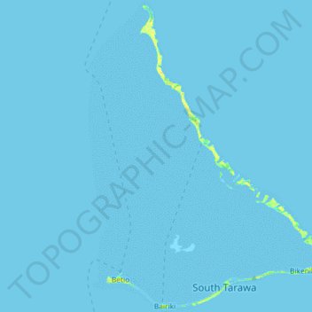
Name: Tarawa topographic map, elevation, terrain.
Location: Tarawa, Kiribati (1.32371 172.89862 1.64193 173.16692)
Average elevation: 0 m
Minimum elevation: 0 m
Maximum elevation: 19 m
Make a donation
Gear up for your next adventure:
As an Amazon Associate, this site earns from qualifying purchases at no extra cost to you.
Other topographic maps
Click on a map to view its topography, its elevation and its terrain.
Malden Island
The island is very low, no more than 10 m (33 ft) above sea level at its highest point. The highest elevations are found along a rim that closely follows the coastline. The interior forms a depression that is only a few metres above sea level in the western part and is below sea level (filled by the lagoon) in…
Average elevation: 2 m
Make a donation
Gear up for your next adventure:
As an Amazon Associate, this site earns from qualifying purchases at no extra cost to you.
Make a donation
Gear up for your next adventure:
As an Amazon Associate, this site earns from qualifying purchases at no extra cost to you.