
Thank you for supporting this site ❤️
Make a donation
Make a donation
Gear up for your next adventure:
As an Amazon Associate, this site earns from qualifying purchases at no extra cost to you.
Yavakapadi topographic map
Click on the map to display elevation.
Thank you for supporting this site ❤️
Make a donation
Make a donation
Gear up for your next adventure:
As an Amazon Associate, this site earns from qualifying purchases at no extra cost to you.
About this map
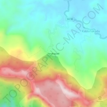
Name: Yavakapadi topographic map, elevation, terrain.
Location: Yavakapadi, Madikeri taluku, Kodagu, Karnataka, 571212, India (12.21176 75.62100 12.25176 75.66100)
Average elevation: 1,116 m
Minimum elevation: 888 m
Maximum elevation: 1,512 m
Thank you for supporting this site ❤️
Make a donation
Make a donation
Gear up for your next adventure:
As an Amazon Associate, this site earns from qualifying purchases at no extra cost to you.