
Thank you for supporting this site ❤️
Make a donation
Make a donation
Gear up for your next adventure:
As an Amazon Associate, this site earns from qualifying purchases at no extra cost to you.
Mont-ral topographic map
Click on the map to display elevation.
Thank you for supporting this site ❤️
Make a donation
Make a donation
Gear up for your next adventure:
As an Amazon Associate, this site earns from qualifying purchases at no extra cost to you.
About this map
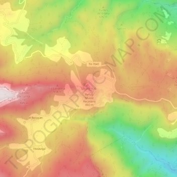
Name: Mont-ral topographic map, elevation, terrain.
Location: Mont-ral, Alto Campo, Tarragona, Cataluña, 43364, España (41.26712 1.07808 41.30712 1.11808)
Average elevation: 722 m
Minimum elevation: 338 m
Maximum elevation: 1,021 m
Thank you for supporting this site ❤️
Make a donation
Make a donation
Gear up for your next adventure:
As an Amazon Associate, this site earns from qualifying purchases at no extra cost to you.