Geolocate

Hennock topographic map

Click on the map to display elevation.

About this map

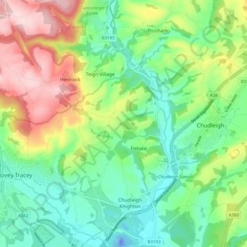
Name: Hennock topographic map, elevation, terrain.

Location: Hennock, Finlake, Teignbridge, Devon, England, United Kingdom (50.57470 -3.69226 50.63520 -3.61432)

Average elevation: 93 m

Minimum elevation: -37 m

Maximum elevation: 263 m

Devon trails, hiking, mountain biking, running and outdoor activities

Gear up for your next adventure:

🧼Biodegradable Soap - Leave-no-trace hygiene for multi-day mountain treks
🔪Outdoor Multi-Tools - Versatile tools for gear repairs and food prep in the wild
🧴Sport Sunscreen Sticks - High-protection sunblock that won't run into your eyes on the trail
🍱Food Containers - Reusable containers for outdoor meals
🛌Insulated Sleeping Mats - Crucial thermal protection when sleeping on cold, uneven ground

As an Amazon Associate, this site earns from qualifying purchases at no extra cost to you.