
Thank you for supporting this site ❤️
Make a donation
Make a donation
Gear up for your next adventure:
As an Amazon Associate, this site earns from qualifying purchases at no extra cost to you.
CENTRO topographic map
Click on the map to display elevation.
Thank you for supporting this site ❤️
Make a donation
Make a donation
Gear up for your next adventure:
As an Amazon Associate, this site earns from qualifying purchases at no extra cost to you.
About this map
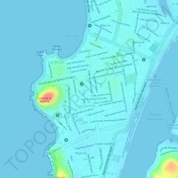
Name: CENTRO topographic map, elevation, terrain.
Location: CENTRO, Mazatlán, Sinaloa, 82000, Mexico (23.19420 -106.42988 23.21156 -106.41096)
Average elevation: 6 m
Minimum elevation: -2 m
Maximum elevation: 82 m
Thank you for supporting this site ❤️
Make a donation
Make a donation
Gear up for your next adventure:
As an Amazon Associate, this site earns from qualifying purchases at no extra cost to you.