
Reuterwanne topographic map
Interactive map
Click on the map to display elevation.
About this map
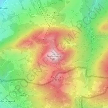
Name: Reuterwanne topographic map, elevation, terrain.
Average elevation: 1,214 m
Minimum elevation: 916 m
Maximum elevation: 1,530 m
Other topographic maps
Click on a map to view its topography, its elevation and its terrain.
Enthalb der Ach
Deutschland > Bayern > Landkreis Oberallgäu > Wertach > Enthalb der Ach
Enthalb der Ach, Wertach, Landkreis Oberallgäu, Bayern, 87497, Deutschland
Average elevation: 984 m