
El Capitan topographic map
Interactive map
Click on the map to display elevation.
About this map
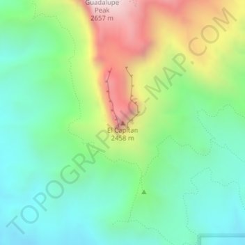
Name: El Capitan topographic map, elevation, terrain.
Location: El Capitan, Culberson County, Texas, 79847, United States (31.87729 -104.85805 31.87739 -104.85795)
Average elevation: 1,916 m
Minimum elevation: 1,564 m
Maximum elevation: 2,613 m
Other topographic maps
Click on a map to view its topography, its elevation and its terrain.
Guadalupe Peak
United States > Texas > Culberson County
Guadalupe Peak, Culberson County, Texas, 79847, United States
Average elevation: 2,151 m