
Thank you for supporting this site ❤️
Make a donation
Make a donation
Gear up for your next adventure:
As an Amazon Associate, this site earns from qualifying purchases at no extra cost to you.
A Fentosa topographic map
Click on the map to display elevation.
Thank you for supporting this site ❤️
Make a donation
Make a donation
Gear up for your next adventure:
As an Amazon Associate, this site earns from qualifying purchases at no extra cost to you.
About this map
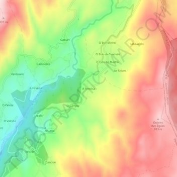
Name: A Fentosa topographic map, elevation, terrain.
Location: A Fentosa, Seixido, A Lama, Pontevedra, Galicia, España (42.41895 -8.38191 42.45895 -8.34191)
Average elevation: 726 m
Minimum elevation: 517 m
Maximum elevation: 930 m
Thank you for supporting this site ❤️
Make a donation
Make a donation
Gear up for your next adventure:
As an Amazon Associate, this site earns from qualifying purchases at no extra cost to you.