
MANCHAG topographic map
Interactive map
Click on the map to display elevation.
About this map
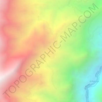
Name: MANCHAG topographic map, elevation, terrain.
Location: MANCHAG, Guachavés (Santacruz), Nariño, Colombia (1.24777 -77.67159 1.26777 -77.65159)
Average elevation: 2,472 m
Minimum elevation: 1,886 m
Maximum elevation: 2,963 m
Other topographic maps
Click on a map to view its topography, its elevation and its terrain.
Guachavés (Santacruz)
Colombia > Nariño > Guachavés (Santacruz)
Guachavés (Santacruz), Nariño, Colombia
Average elevation: 2,631 m