
Freeborn County topographic map
Interactive map
Click on the map to display elevation.
About this map
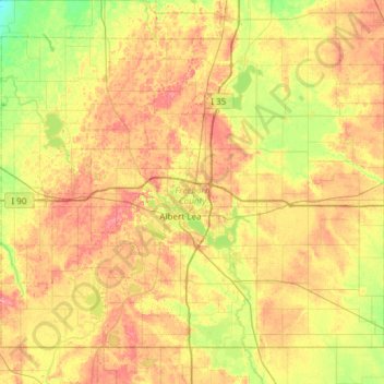
Name: Freeborn County topographic map, elevation, terrain.
Location: Freeborn County, Minnesota, Estados Unidos (43.49943 -93.64863 43.85184 -93.04960)
Average elevation: 380 m
Minimum elevation: 341 m
Maximum elevation: 423 m
Other topographic maps
Click on a map to view its topography, its elevation and its terrain.
International Falls
Estados Unidos > Minnesota > International Falls
International Falls, Koochiching County, Minnesota, Estados Unidos
Average elevation: 347 m
Roseau County
Roseau County, Minnesota, Estados Unidos
Average elevation: 341 m
Woodbury
Estados Unidos > Minnesota > Woodbury
Woodbury, Washington County, Minnesota, Estados Unidos
Average elevation: 289 m
Albert Lea
Estados Unidos > Minnesota > Albert Lea > Albert Lea
Albert Lea, Freeborn County, Minnesota, 56007, Estados Unidos
Average elevation: 382 m