
Thank you for supporting this site ❤️
Make a donation
Make a donation
Gear up for your next adventure:
As an Amazon Associate, this site earns from qualifying purchases at no extra cost to you.
Mörlialp topographic map
Click on the map to display elevation.
Thank you for supporting this site ❤️
Make a donation
Make a donation
Gear up for your next adventure:
As an Amazon Associate, this site earns from qualifying purchases at no extra cost to you.
About this map
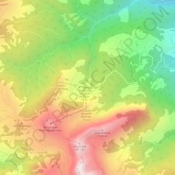
Name: Mörlialp topographic map, elevation, terrain.
Location: Mörlialp, Giswil, Obwalden, 6074, Switzerland (46.80509 8.08958 46.84509 8.12958)
Average elevation: 1,376 m
Minimum elevation: 743 m
Maximum elevation: 2,034 m
Thank you for supporting this site ❤️
Make a donation
Make a donation
Gear up for your next adventure:
As an Amazon Associate, this site earns from qualifying purchases at no extra cost to you.