
Purlear topographic map
Interactive map
Click on the map to display elevation.
About this map
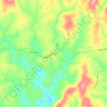
Name: Purlear topographic map, elevation, terrain.
Location: Purlear, Wilkes County, North Carolina, 28651, United States (36.16208 -81.30426 36.20208 -81.26426)
Average elevation: 406 m
Minimum elevation: 338 m
Maximum elevation: 484 m
Other topographic maps
Click on a map to view its topography, its elevation and its terrain.
Moravian Falls
United States > North Carolina > Wilkes County > Moravian Falls
Average elevation: 362 m