
Bizana topographic map
Click on the map to display elevation.
About this map
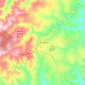
Name: Bizana topographic map, elevation, terrain.
Average elevation: 823 m
Minimum elevation: 676 m
Maximum elevation: 981 m
Other topographic maps
Click on a map to view its topography, its elevation and its terrain.
Ludeke Dam
South Africa > Eastern Cape > Alfred Nzo District Municipality > Mbizana Local Municipality
Average elevation: 810 m
Ludeke Dam
South Africa > Eastern Cape > Alfred Nzo District Municipality > Mbizana Local Municipality
Average elevation: 810 m