
Aokas topographic map
Interactive map
Click on the map to display elevation.
About this map
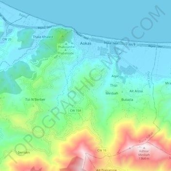
Name: Aokas topographic map, elevation, terrain.
Location: Aokas, Aokas District, Bejaia, 06007, Algeria (36.58666 5.19084 36.65072 5.28712)
Average elevation: 315 m
Minimum elevation: -2 m
Maximum elevation: 1,381 m