Geolocate

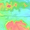
Butibori topographic map

Click on the map to display elevation.

About this map

Name: Butibori topographic map, elevation, terrain.

Location: Butibori, Nagpur Rural Taluka, Nagpur, Maharashtra, India (20.91642 78.98945 20.94727 79.01317)

Average elevation: 271 m

Minimum elevation: 258 m

Maximum elevation: 287 m

Other topographic maps

Click on a map to view its topography, its elevation and its terrain.
Rui

India > Maharashtra > Nagpur Rural Taluka

Average elevation: 301 m

Gumgaon

India > Maharashtra > Nagpur Rural Taluka

Average elevation: 290 m

Bela

India > Maharashtra > Nagpur Rural Taluka

Average elevation: 295 m

Bazargaon

India > Maharashtra > Nagpur Rural Taluka

Average elevation: 409 m

Astha

India > Maharashtra > Nagpur Rural Taluka

Average elevation: 238 m

Gear up for your next adventure:

🧼Technical Clothing Wash - Special soap to clean and restore waterproof membranes
🔪Outdoor Multi-Tools - Versatile tools for gear repairs and food prep in the wild
📚UK Hiking Guidebooks - Detailed route descriptions for the Lake District, Peaks, and Highlands
🦟Anti-Midge & Tick Repellent - Vital for hiking in the Scottish Highlands during summer
🛑Emergency Bivvy Bags - Heat-reflective survival bags for unexpected nights out

As an Amazon Associate, this site earns from qualifying purchases at no extra cost to you.