Geolocate

Denma topographic map

Click on the map to display elevation.

About this map

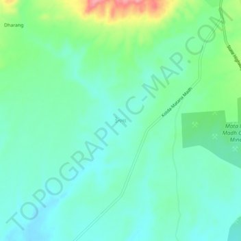
Name: Denma topographic map, elevation, terrain.

Location: Denma, Lakhpat Taluka, Kachchh, Gujarat, 370625, India (23.49933 68.91125 23.53933 68.95125)

Average elevation: 81 m

Minimum elevation: 53 m

Maximum elevation: 161 m

Gear up for your next adventure:

🧭Professional Hiking Compasses - High-precision liquid-filled compasses for map reading and orientation
🧦Merino Wool Hiking Socks - Moisture-wicking socks to prevent blisters during long mountain walks
Camping Shelters - Emergency and lightweight shelters for outdoor use
📻Hand-Crank Emergency Radios - Stay updated on weather warnings in remote areas
🧢Hiking Hats - Sun and weather protection for outdoor walks

As an Amazon Associate, this site earns from qualifying purchases at no extra cost to you.