
Thank you for supporting this site ❤️
Make a donation
Make a donation
Gear up for your next adventure:
As an Amazon Associate, this site earns from qualifying purchases at no extra cost to you.
Floiger topographic map
Click on the map to display elevation.
Thank you for supporting this site ❤️
Make a donation
Make a donation
Gear up for your next adventure:
As an Amazon Associate, this site earns from qualifying purchases at no extra cost to you.
About this map
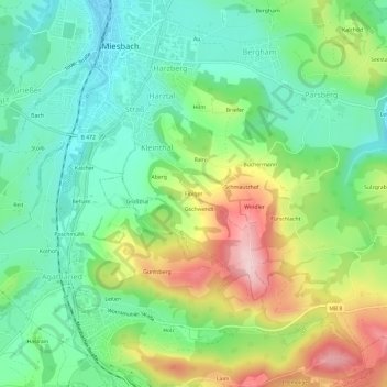
Name: Floiger topographic map, elevation, terrain.
Location: Floiger, Miesbach, Landkreis Miesbach, Bavaria, 83714, Germany (47.75475 11.82480 47.79475 11.86480)
Average elevation: 769 m
Minimum elevation: 683 m
Maximum elevation: 925 m
Thank you for supporting this site ❤️
Make a donation
Make a donation
Gear up for your next adventure:
As an Amazon Associate, this site earns from qualifying purchases at no extra cost to you.