
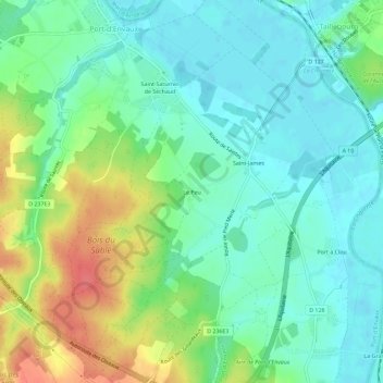
Le Peu topographic map
Interactive map
Click on the map to display elevation.
About this map
Name: Le Peu topographic map, elevation, terrain.
Average elevation: 20 m
Minimum elevation: 0 m
Maximum elevation: 61 m
Other topographic maps
Click on a map to view its topography, its elevation and its terrain.
La Pommeraie des Gaillards
France > Nouvelle-Aquitaine > Charente-Maritime > Port-d'Envaux
La Pommeraie des Gaillards, Port-d'Envaux, Saintes, Charente-Maritime, Nouvelle-Aquitaine, France métropolitaine, 17350, France
Average elevation: 26 m
Les Goumaillauds
France > Nouvelle-Aquitaine > Charente-Maritime > Port-d'Envaux
Les Goumaillauds, Port-d'Envaux, Saintes, Charente-Maritime, Nouvelle-Aquitaine, France métropolitaine, 17350, France
Average elevation: 19 m