
Buterere topographic map
Interactive map
Click on the map to display elevation.
About this map
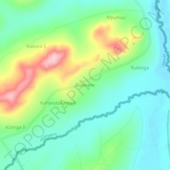
Name: Buterere topographic map, elevation, terrain.
Location: Buterere, Ntungamo, Western Region, Ouganda (-1.14917 30.30300 -1.10917 30.34300)
Average elevation: 1,376 m
Minimum elevation: 1,318 m
Maximum elevation: 1,506 m
Other topographic maps
Click on a map to view its topography, its elevation and its terrain.