
Abarkuh topographic map
Interactive map
Click on the map to display elevation.
Abarkuh
Abarkuh is located at an altitude of 1510 metres (4954 feet). An ancient living cypress tree, the Sarv-e-Abarqu, is located here.
About this map
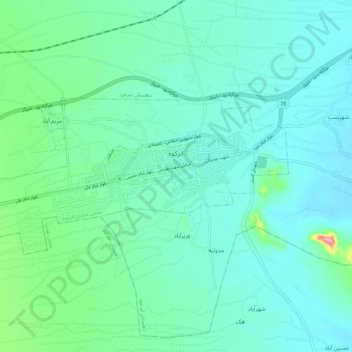
Name: Abarkuh topographic map, elevation, terrain.
Average elevation: 1,515 m
Minimum elevation: 1,488 m
Maximum elevation: 1,644 m