Baan Tha Po topographic map
Click on the map to display elevation.
About this map

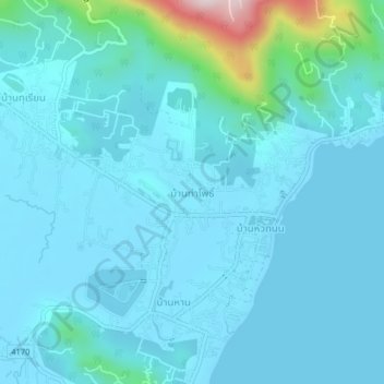
Name: Baan Tha Po topographic map, elevation, terrain.
Location: Baan Tha Po, Surat Thani Province, 84310, Thailand (9.42560 99.99480 9.46560 100.03480)
Average elevation: 50 m
Minimum elevation: -1 m
Maximum elevation: 467 m
Other topographic maps
Click on a map to view its topography, its elevation and its terrain.

Ko Samui
Thailand > Surat Thani Province
Ko Samui, Surat Thani Province, Thailand
Average elevation: 75 m

Ko Pha Ngan
Thailand > Surat Thani Province
Ko Pha Ngan, Surat Thani Province, Thailand
Average elevation: 84 m

Ban Na Doem
Thailand > Surat Thani Province
Ban Na Doem, Surat Thani Province, Thailand
Average elevation: 27 m

Ko Pha-ngan
Thailand > Surat Thani Province
Ko Pha-ngan, Phet Pha-ngan, Surat Thani Province, 84280, Thailand
Average elevation: 30 m

Khao Lat Mai Kaeo
Thailand > Surat Thani Province
Khao Lat Mai Kaeo, Ban Tai, Surat Thani Province, Thailand
Average elevation: 142 m

Haad Khuat
Thailand > Surat Thani Province
Haad Khuat, Phet Pha-ngan, Surat Thani Province, Thailand
Average elevation: 116 m

Baan Bang Rak
Thailand > Surat Thani Province
Baan Bang Rak, Surat Thani Province, 84320, Thailand
Average elevation: 21 m

Moo 1
Thailand > Surat Thani Province
Moo 1, Surat Thani Province, 84-280, Thailand
Average elevation: 21 m

Haad Salad
Thailand > Surat Thani Province
Haad Salad, Surat Thani Province, 84820, Thailand
Average elevation: 59 m