
Marais de la Rivière aux Cerises topographic map
Interactive map
Click on the map to display elevation.
About this map
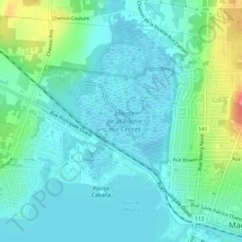
Name: Marais de la Rivière aux Cerises topographic map, elevation, terrain.
Average elevation: 220 m
Minimum elevation: 204 m
Maximum elevation: 275 m
Other topographic maps
Click on a map to view its topography, its elevation and its terrain.
Lac Memphrémagog
Lac Memphrémagog, Chemin Viens, Southière-sur-le-Lac, Magog, Memphrémagog, Estrie, Québec, J1X 0J1, Canada
Average elevation: 214 m
Lac Lovering
Canada > Québec > Stanstead (Canton) > Magog
Lac Lovering, Stanstead (Canton), Memphrémagog, Estrie, Québec, Canada
Average elevation: 280 m