
Thank you for supporting this site ❤️
Make a donation
Make a donation
Gear up for your next adventure:
As an Amazon Associate, this site earns from qualifying purchases at no extra cost to you.
Jaufen topographic map
Click on the map to display elevation.
Thank you for supporting this site ❤️
Make a donation
Make a donation
Gear up for your next adventure:
As an Amazon Associate, this site earns from qualifying purchases at no extra cost to you.
About this map
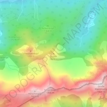
Name: Jaufen topographic map, elevation, terrain.
Location: Jaufen, Halblech, Landkreis Ostallgäu, Bavaria, Germany (47.58819 10.89151 47.58829 10.89161)
Average elevation: 1,419 m
Minimum elevation: 1,079 m
Maximum elevation: 1,894 m
Thank you for supporting this site ❤️
Make a donation
Make a donation
Gear up for your next adventure:
As an Amazon Associate, this site earns from qualifying purchases at no extra cost to you.