Geolocate

Prodromos topographic map

Click on the map to display elevation.

About this map

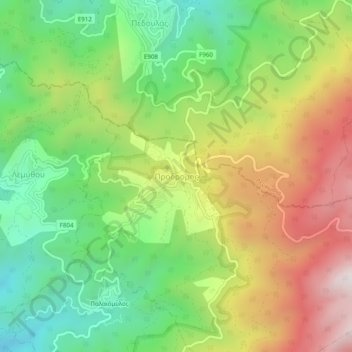
Name: Prodromos topographic map, elevation, terrain.

Location: Prodromos, Limassol District, Cyprus, 2850, Cyprus (34.92995 32.81249 34.96995 32.85249)

Average elevation: 1,311 m

Minimum elevation: 868 m

Maximum elevation: 1,910 m

Gear up for your next adventure:

❄️Walking Crampons - Added traction for icy slopes and winter peak bagging
🧘Folding Sit Mats - Dry and warm seat for map-reading breaks on damp ground
🗺️Ordnance Survey Maps - Official UK maps for walking and outdoor activities
📍Handheld GPS Navigators - Reliable satellite navigation for hiking and off-road exploration
📻Hand-Crank Emergency Radios - Stay updated on weather warnings in remote areas

As an Amazon Associate, this site earns from qualifying purchases at no extra cost to you.