Geolocate

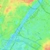
75006 topographic map

Click on the map to display elevation.

About this map

Name: 75006 topographic map, elevation, terrain.

Location: 75006, Paris, Ile-de-France, Metropolitan France, France (48.83966 2.31657 48.85935 2.34462)

Average elevation: 52 m

Minimum elevation: 26 m

Maximum elevation: 82 m

Other topographic maps

Click on a map to view its topography, its elevation and its terrain.

Fountain of the Rivers

France > Ile-de-France > Paris

Average elevation: 47 m

Parc des Buttes Chaumont

France > Ile-de-France > Paris

Average elevation: 73 m

Field of Mars

France > Ile-de-France > Paris

Average elevation: 48 m

Parc des Buttes Chaumont

France > Ile-de-France > Paris

Average elevation: 73 m

Jardin des Cévennes

France > Ile-de-France > Paris

Average elevation: 43 m

Square des Batignolles

France > Ile-de-France > Paris

Average elevation: 53 m

Parc de Belleville

France > Ile-de-France > Paris

Average elevation: 77 m

Jardin du Ranelagh

France > Ile-de-France > Paris

Average elevation: 52 m

Gear up for your next adventure:

🔋Power Banks - Portable chargers for long outdoor trips
❄️Walking Crampons - Added traction for icy slopes and winter peak bagging
📢Survival Whistles - Essential safety gear for signaling for help in mountain fog
🛑Emergency Bivvy Bags - Heat-reflective survival bags for unexpected nights out
🪢Paracord - Multi-purpose cord for camping and survival

As an Amazon Associate, this site earns from qualifying purchases at no extra cost to you.