Geolocate

Garden Lake topographic map

Interactive map

Click on the map to display elevation.

About this map

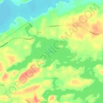
Name: Garden Lake topographic map, elevation, terrain.

Location: Garden Lake, Lake County, Minnesota, United States (47.91222 -91.77648 47.93363 -91.71804)

Average elevation: 426 m

Minimum elevation: 396 m

Maximum elevation: 459 m

Other topographic maps

Click on a map to view its topography, its elevation and its terrain.

Silver Bay

United States > Minnesota > Lake County

Silver Bay, Lake County, Minnesota, 55614, United States

Average elevation: 247 m

Hum Lake

United States > Minnesota > Lake County

Hum Lake, Lake County, Minnesota, United States

Average elevation: 468 m

Castle Danger

United States > Minnesota > Lake County

Castle Danger, Lake County, Minnesota, United States

Average elevation: 212 m

Griddle Lake

United States > Minnesota > Lake County

Griddle Lake, Lake County, Minnesota, United States

Average elevation: 444 m

Silver Bay

United States > Minnesota > Lake County > Silver Bay > Silver Bay

Silver Bay, Lake County, Minnesota, 55614, United States

Average elevation: 256 m

Bow Lake

United States > Minnesota > Lake County

Bow Lake, Lake County, Minnesota, United States

Average elevation: 477 m

Beaver Bay

United States > Minnesota > Lake County

Beaver Bay, Lake County, Minnesota, 55601, United States

Average elevation: 212 m

Two Harbors

United States > Minnesota > Lake County

Two Harbors, Lake County, Minnesota, United States

Average elevation: 221 m

Gull Lake

United States > Minnesota > Lake County

Gull Lake, Lake County, Minnesota, United States

Average elevation: 467 m

Lake of the Clouds

United States > Minnesota > Lake County

Lake of the Clouds, Lake County, Minnesota, United States

Average elevation: 466 m