苏拉木塔格峰 topographic map
Interactive map
Click on the map to display elevation.
About this map
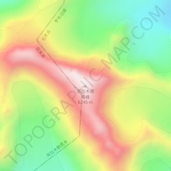
Name: 苏拉木塔格峰 topographic map, elevation, terrain.
Average elevation: 5,790 m
Minimum elevation: 5,375 m
Maximum elevation: 6,243 m

Click on the map to display elevation.
Name: 苏拉木塔格峰 topographic map, elevation, terrain.
Average elevation: 5,790 m
Minimum elevation: 5,375 m
Maximum elevation: 6,243 m