
Frenchburg topographic map
Interactive map
Click on the map to display elevation.
About this map
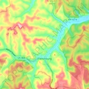
Name: Frenchburg topographic map, elevation, terrain.
Location: Frenchburg, Menifee County, Kentucky, United States (37.93336 -83.65464 37.98465 -83.60859)
Average elevation: 330 m
Minimum elevation: 243 m
Maximum elevation: 424 m