
Hardwick topographic map
Click on the map to display elevation.
About this map
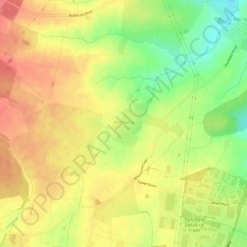
Name: Hardwick topographic map, elevation, terrain.
Location: Hardwick, North Northamptonshire, England, United Kingdom (52.30904 -0.79294 52.33162 -0.73546)
Average elevation: 110 m
Minimum elevation: 69 m
Maximum elevation: 140 m
North Northamptonshire trails, hiking, mountain biking, running and outdoor activities
Other topographic maps
Click on a map to view its topography, its elevation and its terrain.
Irchester Country Park
United Kingdom > England > North Northamptonshire > Little Irchester
Average elevation: 60 m
River Nene Navigation
United Kingdom > England > North Northamptonshire > Irchester
Average elevation: 55 m