
Make a donation
Gear up for your next adventure:
As an Amazon Associate, this site earns from qualifying purchases at no extra cost to you.
Sutton at Hone topographic map
Click on the map to display elevation.
Make a donation
Gear up for your next adventure:
As an Amazon Associate, this site earns from qualifying purchases at no extra cost to you.
About this map
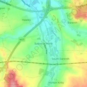
Name: Sutton at Hone topographic map, elevation, terrain.
Location: Sutton at Hone, Dartford, Kent, England, DA4 9ET, United Kingdom (51.39098 0.21539 51.43098 0.25539)
Average elevation: 44 m
Minimum elevation: 7 m
Maximum elevation: 109 m
Kent trails, hiking, mountain biking, running and outdoor activities
Make a donation
Gear up for your next adventure:
As an Amazon Associate, this site earns from qualifying purchases at no extra cost to you.
Other topographic maps
Click on a map to view its topography, its elevation and its terrain.
Make a donation
Gear up for your next adventure:
As an Amazon Associate, this site earns from qualifying purchases at no extra cost to you.