
Ojo de Agua topographic map
Interactive map
Click on the map to display elevation.
About this map
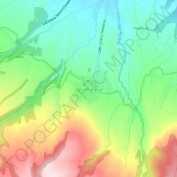
Name: Ojo de Agua topographic map, elevation, terrain.
Location: Ojo de Agua, Zinacantepec, State of Mexico, 51384, Mexico (19.19564 -99.79075 19.23564 -99.75075)
Average elevation: 3,051 m
Minimum elevation: 2,904 m
Maximum elevation: 3,283 m