
Sixmilebridge topographic map
Interactive map
Click on the map to display elevation.
About this map
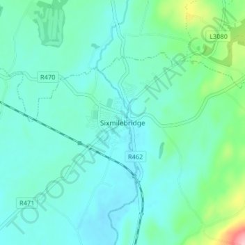
Name: Sixmilebridge topographic map, elevation, terrain.
Location: Sixmilebridge, County Clare, Munster, V95VF40, Ireland (52.72139 -8.79417 52.76139 -8.75417)
Average elevation: 31 m
Minimum elevation: -1 m
Maximum elevation: 175 m