Geolocate

Botwood topographic map

Click on the map to display elevation.

About this map

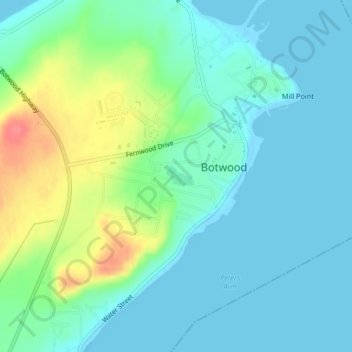
Name: Botwood topographic map, elevation, terrain.

Location: Botwood, Newfoundland, Newfoundland and Labrador, Canada (49.14071 -55.35047 49.14227 -55.34710)

Average elevation: 17 m

Minimum elevation: 0 m

Maximum elevation: 67 m

Gear up for your next adventure:

🌄Outdoor Binoculars - Compact binoculars for landscape observation
🥾Women's Waterproof Hiking Boots - High-performance trekking boots designed for all-weather comfort
❄️Walking Crampons - Added traction for icy slopes and winter peak bagging
🧥Packable Down Jackets - Lightweight warmth that compresses small in your bag
🔭Compact Hiking Binoculars - Lightweight optics for scouting terrain and spotting wildlife

As an Amazon Associate, this site earns from qualifying purchases at no extra cost to you.