
Thank you for supporting this site ❤️
Make a donation
Make a donation
Gear up for your next adventure:
As an Amazon Associate, this site earns from qualifying purchases at no extra cost to you.
Henryetta topographic map
Click on the map to display elevation.
Thank you for supporting this site ❤️
Make a donation
Make a donation
Gear up for your next adventure:
As an Amazon Associate, this site earns from qualifying purchases at no extra cost to you.
About this map
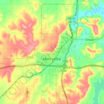
Name: Henryetta topographic map, elevation, terrain.
Location: Henryetta, Okmulgee County, Oklahoma, 74437, United States (35.39594 -96.05229 35.49663 -95.94615)
Average elevation: 236 m
Minimum elevation: 183 m
Maximum elevation: 299 m
Thank you for supporting this site ❤️
Make a donation
Make a donation
Gear up for your next adventure:
As an Amazon Associate, this site earns from qualifying purchases at no extra cost to you.