Geolocate

Myrtle Beach topographic map

Click on the map to display elevation.

About this map

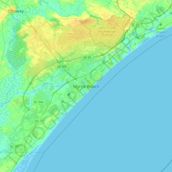
Name: Myrtle Beach topographic map, elevation, terrain.

Location: Myrtle Beach, Horry County, South Carolina, United States (33.53565 -79.05004 33.85565 -78.73004)

Average elevation: 4 m

Minimum elevation: -5 m

Maximum elevation: 17 m

Gear up for your next adventure:

🔦Keychain LED Torches - Emergency backup light for finding gear in your pack
🥾Hiking Boot Waterproofing Wax - Maintain the lifespan of your leather trekking boots
📕Outdoor Navigation Books - Learn traditional and modern navigation techniques
🧺Mesh Stuff Sacks - Breathable storage for wet gear or camp organization
👕Merino Base Layers - Natural temperature regulation for cold weather hiking and camping

As an Amazon Associate, this site earns from qualifying purchases at no extra cost to you.