Geolocate

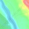
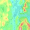
Sirkka topographic map

Click on the map to display elevation.

About this map
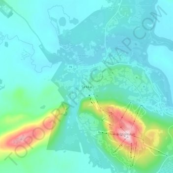
Name: Sirkka topographic map, elevation, terrain.

Location: Sirkka, Kittilä, Fell Lapland sub-region, Lapland, Mainland Finland, 99130, Finland (67.76756 24.76557 67.84756 24.84557)

Average elevation: 230 m

Minimum elevation: 178 m

Maximum elevation: 528 m

Other topographic maps

Click on a map to view its topography, its elevation and its terrain.

Kolari

Finland > Lapland

Average elevation: 203 m

Kemi

Finland > Lapland

Average elevation: 4 m

Ivalo

Finland > Lapland > Inari

Average elevation: 125 m

Pello

Finland > Lapland

Average elevation: 153 m

Sodankylä

Finland > Lapland

Average elevation: 248 m

Enontekiö

Finland > Lapland

The lower heathlands are dominated by shrubs such as Betula nana, Vaccinium myrtillus and Empetrum hermaphroditum, whereas in the fjell heaths at higher elevations Salix herbacea, Empetrum and alpine grasses with lichens and mosses occur. In the mountains of the north-west Cassiope tetragona is abundant. The…

Average elevation: 405 m
Rovaniemi

Finland > Lapland

Average elevation: 167 m

Käsivarsi Wilderness Area

Finland > Lapland

Average elevation: 629 m

Kemi

Finland > Lapland

Average elevation: 4 m

Lemmenjoki National Park

Finland > Lapland

Average elevation: 325 m

Inari

Finland > Lapland

Average elevation: 256 m

Pyhä-Luosto National Park

Finland > Lapland

Average elevation: 225 m

Jerisjärvi

Finland > Lapland > Kittilä

Average elevation: 295 m

Kaldoaivin erämaa-alue

Finland > Lapland

Average elevation: 230 m

Rovaniemi

Finland > Lapland

Average elevation: 167 m

Urho Kekkonen National Park

Finland > Lapland

Average elevation: 271 m

Karhunkierros

Finland > Lapland > Kolari

Average elevation: 124 m

Kittilä

Finland > Lapland

Kittilä has a subarctic climate (Dfc) as a result of its northerly location and being far inland, which renders strong seasonal shifts. The sun does not set between 30 May and 15 July (47 days), and white nights lasts from early May to early August. The period that the sun does not rise lasts from 14 December…

Average elevation: 254 m
Ivalo

Finland > Lapland

Average elevation: 125 m

Kemijärvi

Finland > Lapland

Average elevation: 208 m

Posio

Finland > Lapland

Average elevation: 262 m

Yllästunturi

Finland > Lapland > Kolari

Average elevation: 414 m

Kolari

Finland > Lapland

Average elevation: 203 m

Äkäsjärvi

Finland > Lapland > Muonio

Average elevation: 310 m

Tornio

Finland > Lapland

Average elevation: 46 m

Urho Kekkonen National Park

Finland > Lapland

Average elevation: 271 m

Korouoma

Finland > Lapland > Posio

Average elevation: 233 m

Muonio

Finland > Lapland

Average elevation: 280 m

Simo

Finland > Lapland

Average elevation: 47 m

Kemijärvi

Finland > Lapland

Average elevation: 208 m

Kaldoaivin erämaa-alue

Finland > Lapland

Average elevation: 230 m

Kittilä

Finland > Lapland

Kittilä has a subarctic climate (Dfc) as a result of its northerly location and being far inland, which renders strong seasonal shifts. The sun does not set between 30 May and 15 July (47 days), and white nights lasts from early May to early August. The period that the sun does not rise lasts from 14 December…

Average elevation: 254 m
Rovaniemi

Finland > Lapland

Average elevation: 167 m

Sodankylä

Finland > Lapland

Average elevation: 248 m

Gear up for your next adventure:

📕Outdoor Navigation Books - Learn traditional and modern navigation techniques
👖Hiking Trousers - Durable trousers designed for rough terrain
🦟Anti-Midge & Tick Repellent - Vital for hiking in the Scottish Highlands during summer
🧰Survival Kits - Emergency tools for remote environments
🧢Thermal Beanie Hats - Prevent heat loss from the head in windy summit conditions

As an Amazon Associate, this site earns from qualifying purchases at no extra cost to you.