
Thank you for supporting this site ❤️
Make a donation
Make a donation
Gear up for your next adventure:
As an Amazon Associate, this site earns from qualifying purchases at no extra cost to you.
Budhni topographic map
Click on the map to display elevation.
Thank you for supporting this site ❤️
Make a donation
Make a donation
Gear up for your next adventure:
As an Amazon Associate, this site earns from qualifying purchases at no extra cost to you.
About this map
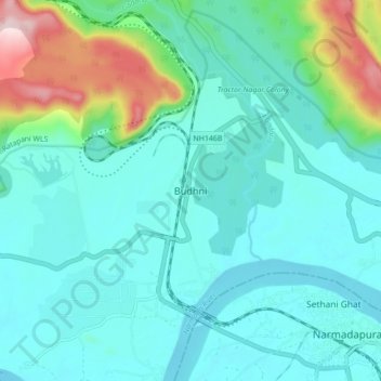
Name: Budhni topographic map, elevation, terrain.
Location: Budhni, Budni Tahsil, Sehore, Madhya Pradesh, 466441, India (22.74470 77.64295 22.82470 77.72295)
Average elevation: 346 m
Minimum elevation: 280 m
Maximum elevation: 627 m
Thank you for supporting this site ❤️
Make a donation
Make a donation
Gear up for your next adventure:
As an Amazon Associate, this site earns from qualifying purchases at no extra cost to you.