
Dunion Hill topographic map
Interactive map
Click on the map to display elevation.
About this map
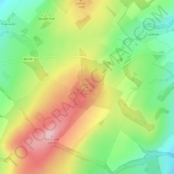
Name: Dunion Hill topographic map, elevation, terrain.
Average elevation: 236 m
Minimum elevation: 147 m
Maximum elevation: 338 m
Other topographic maps
Click on a map to view its topography, its elevation and its terrain.
Castlewood Farm
United Kingdom > Scotland > Scottish Borders > Jedburgh
Castlewood Farm, Jedburgh, Scottish Borders, Scotland, TD8 6QA, United Kingdom
Average elevation: 175 m