
Winnipeg Beach topographic map
Interactive map
Click on the map to display elevation.
About this map
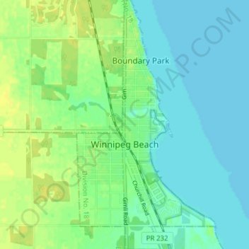
Name: Winnipeg Beach topographic map, elevation, terrain.
Location: Winnipeg Beach, Division No. 18, Manitoba, R0C 3G0, Canada (50.48794 -96.98737 50.52756 -96.95261)
Average elevation: 222 m
Minimum elevation: 215 m
Maximum elevation: 232 m
Other topographic maps
Click on a map to view its topography, its elevation and its terrain.
Rural Municipality of St. Laurent
Canada > Manitoba > Division No. 18
Rural Municipality of St. Laurent, Division No. 18, Manitoba, R0C 2S0, Canada
Average elevation: 260 m