Geolocate

Speedwell topographic map

Click on the map to display elevation.

About this map

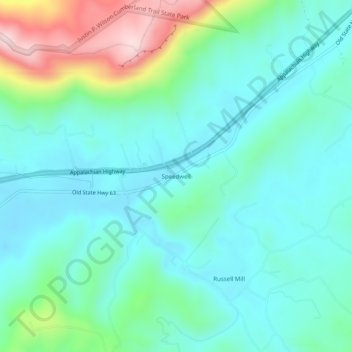
Name: Speedwell topographic map, elevation, terrain.

Location: Speedwell, Claiborne County, Tennessee, 37870, United States (36.43869 -83.89186 36.47869 -83.85186)

Average elevation: 416 m

Minimum elevation: 328 m

Maximum elevation: 710 m

Gear up for your next adventure:

🧭GPS Trackers - Tracking devices for safety and navigation
🧣Neck Gaiters - Protects against wind and sun on exposed ridges and peaks
🧺Microfibre Travel Towels - Fast-drying and compact towels for wild swimming and camping
📷Outdoor Action Cameras - Cameras designed for hiking and adventure
🦟Anti-Midge & Tick Repellent - Vital for hiking in the Scottish Highlands during summer

As an Amazon Associate, this site earns from qualifying purchases at no extra cost to you.