
Make a donation
Gear up for your next adventure:
As an Amazon Associate, this site earns from qualifying purchases at no extra cost to you.
At Tafila topographic map
Click on the map to display elevation.
Make a donation
Gear up for your next adventure:
As an Amazon Associate, this site earns from qualifying purchases at no extra cost to you.
At Tafila
The region's economy depends partially on agriculture. The towns in the governorate are mostly located at elevations exceeding 1000m above sea level, with Tafilah at 940m above sea level, and the governorate receives an average annual rainfall of 240 mm.
Make a donation
Gear up for your next adventure:
As an Amazon Associate, this site earns from qualifying purchases at no extra cost to you.
About this map
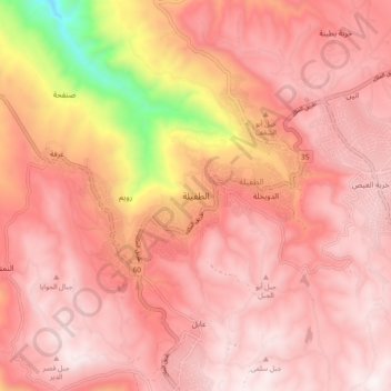
Name: At Tafila topographic map, elevation, terrain.
Average elevation: 1,078 m
Minimum elevation: 275 m
Maximum elevation: 1,372 m
Make a donation
Gear up for your next adventure:
As an Amazon Associate, this site earns from qualifying purchases at no extra cost to you.