Geolocate

Hellingly topographic map

Click on the map to display elevation.

About this map

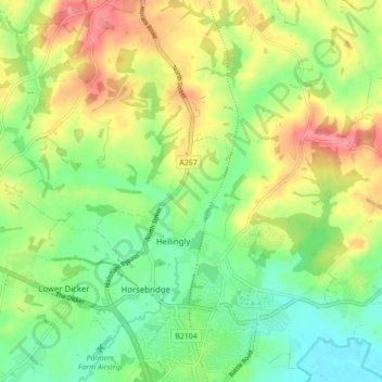
Name: Hellingly topographic map, elevation, terrain.

Location: Hellingly, Wealden, East Sussex, England, United Kingdom (50.87077 0.20185 50.92025 0.28807)

Average elevation: 34 m

Minimum elevation: 0 m

Maximum elevation: 80 m

East Sussex trails, hiking, mountain biking, running and outdoor activities

Gear up for your next adventure:

🛑Emergency Bivvy Bags - Heat-reflective survival bags for unexpected nights out
🧭Orienteering Compasses - Accurate compasses for map-based navigation
🧼Technical Clothing Wash - Special soap to clean and restore waterproof membranes
🔦Head Torches - Hands-free lighting for hiking and camping
🥾Hiking Boots - Waterproof and durable boots for long-distance hiking in the UK

As an Amazon Associate, this site earns from qualifying purchases at no extra cost to you.