
Bayanga topographic map
Interactive map
Click on the map to display elevation.
About this map
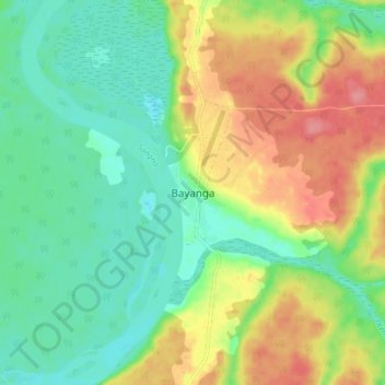
Name: Bayanga topographic map, elevation, terrain.
Location: Bayanga, Sangha-Mbaéré, Central African Republic (2.87240 16.22114 2.95240 16.30114)
Average elevation: 387 m
Minimum elevation: 353 m
Maximum elevation: 440 m