
Balakot topographic map
Interactive map
Click on the map to display elevation.
About this map
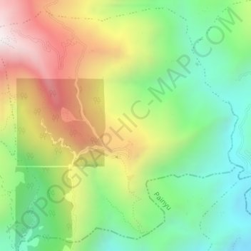
Name: Balakot topographic map, elevation, terrain.
Location: Balakot, Mahashila, Parbat, Gandaki Pradesh, Nepal (28.07356 83.65826 28.09884 83.68806)
Average elevation: 1,273 m
Minimum elevation: 802 m
Maximum elevation: 1,942 m
Other topographic maps
Click on a map to view its topography, its elevation and its terrain.