
Lac Wiyâshâkimî topographic map
Interactive map
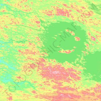
Click on the map to display elevation.
About this map
Name: Lac Wiyâshâkimî topographic map, elevation, terrain.
Average elevation: 269 m
Minimum elevation: 210 m
Maximum elevation: 416 m
Other topographic maps
Click on a map to view its topography, its elevation and its terrain.
Cap Hopes Advance
Kanada > Québec > ᑲᑎᕕᒃ Kativik > ᖁᐊᖅᑕᖅ (ᐊᕕᒃᑐᖅᓯᒪᓂᖓ) / Quaqtaq (terre)
Cap Hopes Advance, ᖁᐊᖅᑕᖅ (ᐊᕕᒃᑐᖅᓯᒪᓂᖓ) / Quaqtaq (terre), ᑲᑎᕕᒃ Kativik, Québec, Kanada
Average elevation: 32 m