Geolocate

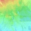
Letang topographic map

Click on the map to display elevation.

About this map

Name: Letang topographic map, elevation, terrain.

Location: Letang, Morang, Koshi Province, Nepal (26.66672 87.44068 26.86327 87.61362)

Average elevation: 616 m

Minimum elevation: 119 m

Maximum elevation: 2,373 m

Other topographic maps

Click on a map to view its topography, its elevation and its terrain.

Bakra

Nepal > Koshi Province > Morang

Average elevation: 228 m

Sundarharaicha

Nepal > Koshi Province > Morang

Average elevation: 228 m

Betana Wetlands

Nepal > Koshi Province > Morang

Average elevation: 136 m

Pathari

Nepal > Koshi Province > Morang

Average elevation: 139 m

Gear up for your next adventure:

🧥Breathable Waterproof Jackets - Essential rain protection for the unpredictable British climate
📷Camera Straps - Secure straps for carrying cameras while walking
📱Phone Mounts for Hiking - Secure mounts to carry your phone on trails
🛑Emergency Bivvy Bags - Heat-reflective survival bags for unexpected nights out
🥾Hiking Boots - Waterproof and durable boots for long-distance hiking in the UK

As an Amazon Associate, this site earns from qualifying purchases at no extra cost to you.