
okres Hlavní město Praha topographic map
Interactive map
Click on the map to display elevation.
About this map
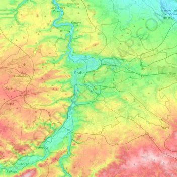
Name: okres Hlavní město Praha topographic map, elevation, terrain.
Location: okres Hlavní město Praha, Praha, Tcheca (49.94190 14.22444 50.17743 14.70679)
Average elevation: 300 m
Minimum elevation: 167 m
Maximum elevation: 508 m
Other topographic maps
Click on a map to view its topography, its elevation and its terrain.