
Thank you for supporting this site ❤️
Make a donation
Make a donation
Gear up for your next adventure:
As an Amazon Associate, this site earns from qualifying purchases at no extra cost to you.
Brookfield topographic map
Click on the map to display elevation.
Thank you for supporting this site ❤️
Make a donation
Make a donation
Gear up for your next adventure:
As an Amazon Associate, this site earns from qualifying purchases at no extra cost to you.
About this map
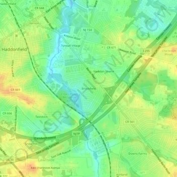
Name: Brookfield topographic map, elevation, terrain.
Average elevation: 21 m
Minimum elevation: 4 m
Maximum elevation: 38 m
Thank you for supporting this site ❤️
Make a donation
Make a donation
Gear up for your next adventure:
As an Amazon Associate, this site earns from qualifying purchases at no extra cost to you.
Other topographic maps
Click on a map to view its topography, its elevation and its terrain.
Barclay-Kingston
United States > New Jersey > Camden County > Cherry Hill Township
Average elevation: 18 m
Golden Triangle
United States > New Jersey > Camden County > Cherry Hill Township
Average elevation: 13 m