
Canvey Island topographic map
Interactive map
Click on the map to display elevation.
About this map
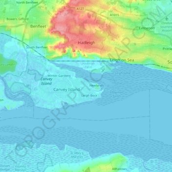
Name: Canvey Island topographic map, elevation, terrain.
Location: Canvey Island, Castle Point, Essex, England, United Kingdom (51.50075 0.51573 51.54768 0.70416)
Average elevation: 14 m
Minimum elevation: -3 m
Maximum elevation: 87 m
Other topographic maps
Click on a map to view its topography, its elevation and its terrain.
Winter Gardens
United Kingdom > England > Castle Point > Winter Gardens
Winter Gardens, Castle Point, Essex, East of England, England, SS8 9QU, United Kingdom
Average elevation: 9 m